Historic Mount Kisco Maps
Aerial View Map of Mount Kisco - 1927
The firm of Hughes & Cinquin produced panoramic maps of villages and towns during the 1920s under the sponsorship of Oakley S. Bailey (1843-1947), a panoramic map artist and publisher. This unique aero-view map of Mount Kisco highlights and lists historic firehouses, schools, churches and businesses from 1927.¹
Mount Kisco Aerial View, 1927
Sanborn Insurance Map of Mount Kisco - 1885
Originally published by The Sanborn Map Company (Sanborn), these maps were created to allow fire insurance companies to assess their total liability in urbanized areas of the United States. This unique insurance map provides a detailed historic view of Mount Kisco as it looked in 1885.¹
Mount Kisco Insurance Map, 1885
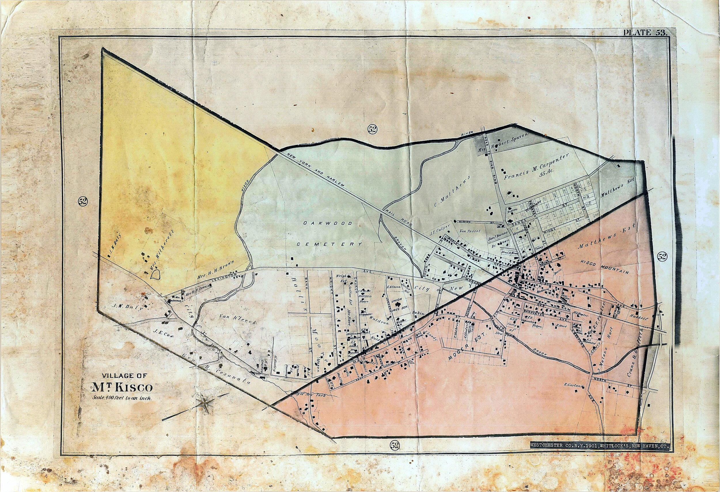
New York City’s Search For Water Map - Eminent Domain 1900
New York city in the late 1800's and early 1900's was expanding its water system throughout Westchester by building reservoirs and also protecting the rivers and streams that flow into those reservoirs. The Branch Brook and Kisco River that flow through Mount Kisco feed into the NYC Croton Reservoir. To protect the purIty of the water the city via the legal mechanism of Eminent Domain (the right of a government agency to take private land for the greater public good) took and destroyed businesses and homes in Mount Kisco along the Branch Brook and Kisco River. This map created by NYC depicts the land along the rivers in Mount Kisco that was being claimed by New York at that time.¹
Mount Kisco Watershed Map Plate 53, undated
Mount Kisco Map Plate 53, 1901
¹Source: Harry McCartney, Mount Kisco Historical Society


